 BDT GeoCatalogue
FAO
Type of resources
Topics
Keywords
Contact for the resource
Provided by
Formats
Representation types
Update frequencies
status
-
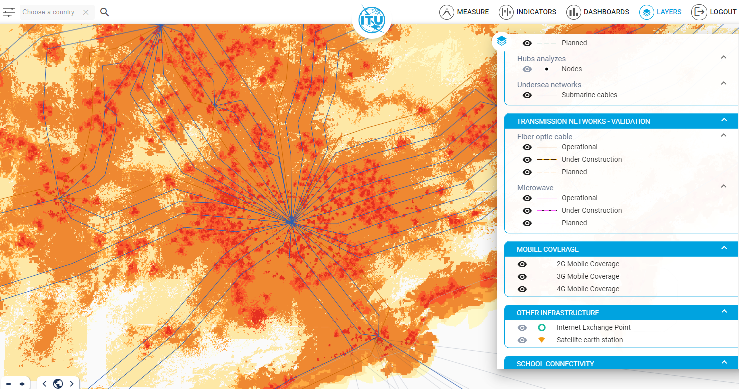
Published by Collins Bartholomew in partnership with Global System for Mobile Communications (GSMA), the Mobile Coverage Explorer is a raster data representation of the area covered by mobile cellular networks around the world. Data_MCE global coverage has been sourced from the network operators and created from submissions made directly to Collins Bartholomew or to GSMA, from operators who provide roaming detail for inclusion in the GSMA’s Network Coverage Maps web application (https://www.gsma.com/coverage). The dataset is provided at Global and National level. Global datasets contain the merged global coverages with the following file naming convention. MCE_Global<Technology>_<DataRelease>, where technology is ‘4G’. At country level the rasters depict the network coverage in each country for each technology. Therefore a country is not defined by its border extent but rather by the coverage supplied by network operators with licences in that country. In the file naming convention, countries are identified using their ISO 3166-1 code as follows: MCE_<ISO2Code><Technology>_<DataRelease>. The cell value in the MCE rasters are as follows: 1 - strong signal 2 - variable signal strength This data is supplemented with coverage created from OpenCellID (please see link in the associated resources of this metadata).