BDT GeoCatalogue
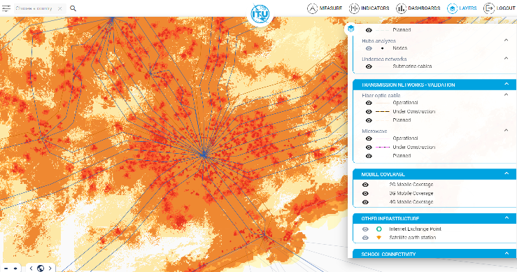
Mobile Coverage Explorer 2021 - Operator submission (MCE) 4G Network Coverage (Global, National - 260m)
Published by Collins Bartholomew in partnership with Global System for Mobile Communications (GSMA), the Mobile Coverage Explorer is a raster data representation of the area covered by mobile cellular networks around the world.
Data_MCE global coverage has been sourced from the network operators and created from submissions made directly to Collins Bartholomew or to GSMA, from operators who provide roaming detail for inclusion in the GSMA’s Network Coverage Maps web application ( https://www.gsma.com/coverage).
The dataset is provided at Global and National level.
Global datasets contain the merged global coverages with the following file naming convention. MCE_Global<Technology>_<DataRelease>, where technology is ‘4G’.
At country level the rasters depict the network coverage in each country for each technology. Therefore a country is not defined by its border extent but rather by the coverage supplied by network operators with licences in that country. In the file naming convention, countries are identified using their ISO 3166-1 code as follows: MCE_<ISO2Code><Technology>_<DataRelease>.
The cell value in the MCE rasters are as follows:
1 - strong signal
2 - variable signal strength
This data is supplemented with coverage created from OpenCellID (please see link in the associated resources of this metadata).
Simple
- Date (Publication)
- 2021-01-31
- Edition
-
2021
- Identifier
- https://data.apps.fao.org/map/catalog/srv/resources034c13b9-26f7-484c-98a4-be6e5370ebbd
- Purpose
-
World representation of the area covered by mobile networks for research purpose
- Status
- On going
- Maintenance and update frequency
- Annually
- Theme
-
-
Mobile
-
Coverage
-
Cellular
-
- Place
-
-
World
-
- Access constraints
- Copyright
- Use constraints
- License
- Other constraints
-
Copyright in the Coverage Data belongs to Collins Bartholomew and the GSMA only. All screen images derived or generated from the Coverage Data should incorporate the following acknowledgement: Coverage Data © Collins Bartholomew and GSMA 2021.
The Coverage Data is for research use only, and may not be used for commercial purposes; for clarification, the use of the data to support research that is partially funded by a corporate source does not constitute a commercial purpose. The Coverage Data may be represented in research results as static images, tables or text as necessary to convey research findings, and all screen images derived or generated from the Coverage Data should incorporate the following acknowledgement: Coverage Data © Collins Bartholomew and GSMA 2020. The data may not be redistributed in its raw form.
- Aggregate Datasetindentifier
- 5ce6eb58-7d99-48c3-bb65-af74183b4c17
- Association Type
- Cross reference
- Initiative Type
- Exercise
- Aggregate Datasetindentifier
- 10b85dda-cb68-4ec2-9efd-c7540fd007e6
- Association Type
- Cross reference
- Aggregate Datasetindentifier
- f8c39d43-68ec-487e-b555-d8ea74ce6ce1
- Association Type
- Cross reference
- Spatial representation type
- Grid
- Metadata language
-
eng
- Character set
- UTF8
- Topic category
-
- Utilities communication
- Begin date
- 2010-01-01
- End date
- 2020-12-31
))
- Reference system identifier
- EPSG:3857
- Number of dimensions
- 2
- Dimension name
- Row
- Dimension size
- 82509
- Resolution
- 260 meters
- Dimension name
- Column
- Dimension size
- 151456
- Resolution
- 260 meters
- Cell geometry
- Area
- Transformation parameter availability
- Yes
- Distribution format
-
-
GEOTIF
(
)
-
GEOTIF
(
)
- OnLine resource
- Mobile Coverage Collins Bartholomew ( WWW:LINK-1.0-http--link )
- OnLine resource
- GSMA - Network Coverage Maps ( WWW:LINK-1.0-http--link )
- Hierarchy level
- Dataset
- Statement
-
Data_MCE data is provided directly by operators to GSMA or Collins Bartholomew. However, not every operator has submitted data and so there are inevitable gaps in coverage. The following table shows the percentage number of operators in the latest release that have submitted their coverage data compared to the total number of operators who are members of the GSMA with licenses for each technology.
Technology -- % Operator Submissions
4G -- 29%
In 2020, 55 operators submitted new data for inclusion in the MCE datasets.
Operators are asked to submit strong and variable signal strengths as defined below:
Network Type -- Strong/Indoor -- Variable/Outdoor
4G (LTE) -- Greater than -- -105 dBm -105 to -120 dBm
However, the data received from operators often does not include signal strength information or does not follow the above guidelines. Therefore, whilst the rasters retain the strong and variable distinctions, this inconsistency must be understood by the user.
The cell values in the MCE rasters are as follows:
1 – strong signal strength
2 – variable signal strength
Information on the individual networks included in the MCE and OCI data folders is provided as an Excel spreadsheet called Mobile Coverage Explorer Metadata.xlsx. The columns in the spreadsheet are as follows:
OPERATOR_ID – a unique numerical identifier assigned to each network operator;
NAME – the name of the network operator;
CNTRY_ISO2 - the ISO 3166-1 country code used to describe the territory that the mobile network covers;
COUNTRY - country name, in English, according to Collins Bartholomew’s naming policy;
MCE_<Technology> - A date indicates that this network is included in the MCE coverage data. The date is when the operator’s coverage data was last updated. The format is DD/MM/YYYY.
OCI_<Technology> - A ‘Y’ indicates that this network is included in the OCI coverage data.
If an operator is not listed in the spreadsheet then they have not submitted coverage data to Collins Bartholomew and are not identified in the OpenCellID database.
- File identifier
- 2741dffc-4c7f-4261-9c02-eb54f01f5165 XML
- Metadata language
- English
- Character set
- UTF8
- Parent identifier
-
ba4da895-7a80-4ce7-9e08-db346eaa51b2
ba4da895-7a80-4ce7-9e08-db346eaa51b2
- Date stamp
- 2023-06-12T12:48:26
- Metadata standard name
-
ISO 19115:2003/19139
- Metadata standard version
-
1.0
Overviews
Spatial extent
Provided by