 BDT GeoCatalogue
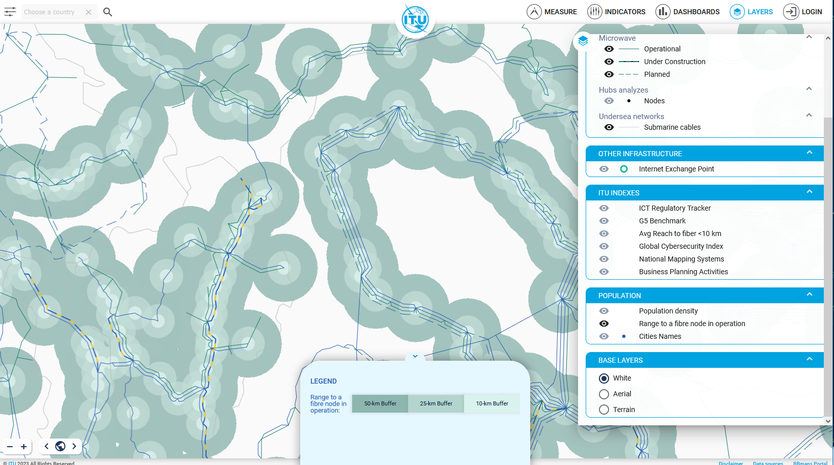
ITU Transmission Networks (BBmaps) - Range to Fibre Node
Range to a Fibre Notes (Access Points) layers from the ITU Broadband Mapping programme (BBmaps) and research
The layer displays 10, 25 and 50 km of distance to a Fibre Node. This is used to calculate the Broadband Capacity Indicator 7 (Percentage of population within reach of transmission networks)
The population living within reach of transmission networks is calculated from network nodes (points) rather than routes (lines), because nodes are access points to the network. This is the equivalent of a motorway: a motorway may pass through areas of high and low population density, but the only means of accessing the motorway are at junctions
Simple
Identification info
- Date (Publication)
- 2023-12-31
- Status
- On going
- Theme
-
-
WMS
-
- Service Type
- OGC:WMS
- Service Version
-
1.3.0
N
S
E
W
))
- Coupling Type
- Tight
- OnLine resource
- range_10km ( OGC:WMS-1.1.1-http-get-capabilities )
- Hierarchy level
- Service
- File identifier
- 669d75ba-a164-4407-978c-e3972c184784 XML
- Metadata language
- English
- Character set
- UTF8
- Hierarchy level
- Service
- Date stamp
- 2025-10-15T09:34:45
- Metadata standard name
-
ISO 19115:2003/19139
- Metadata standard version
-
1.0
Overviews
Spatial extent
N
S
E
W
Provided by

Associated resources
Not available